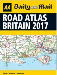
Free inside Saturday’s Daily Mail, every reader will get a brand new 2017 edition Road Atlas. This 32-page A4 guide from the market leaders in UK atlases covers all of England, Scotland and Wales. Perfect for planning any journey in Britain, this fully updated atlas has a 9 miles to 1 inch scale, giving readers clear and concise mapping in an easy-to-use format. Simply pick up a copy of Saturday's paper to get yours!
All comments (30)
stuartbaker80
5 Aug 16#1
They still make these in 2016?
Roger_Irrelevant to stuartbaker80
2 Sep 17#30
What a twunt. :thumbsup:
Newbold
5 Aug 16#2
Do not be conned by this. It's a stunt they pull every year to sell their sordid little toilet paper rag.
It's just a thin paper worthless travesty of an atlas at such a scale that it's really only of use if you happen to be flying a helicopter. Of no use at all as a road atlas.
In much the same way as the Mail's of no use at all as a newspaper.
777James
5 Aug 16#3
So funny Newbold, but 100% absolutely true.
sradmad
5 Aug 16#4
good find op, heat added :smile:
cornishscouse
6 Aug 16#5
2017 ?? How are they going to put in the new stretch of the A30 at Bodmin Cornwall which should open in april 17. Probably many more too. Maybe you get a free marker pen to draw them in. Lol. Good find though.
sJohnson23
6 Aug 16#6
Presumably any area of continental Europe that intrudes onto the map is marked with "Here be dragons".
coolagarry
6 Aug 16#7
Good find. You also get the TV magazine, which is excellent.
crazylegs
6 Aug 16#8
Backup for the glove compartment incase Satnav goes ti ts up
restyler
6 Aug 16#9
To be fair, They do have a cracking centre-spread pullout puzzle page :smile:
RoosterNo1
6 Aug 16#10
Fear not fellow travellers... the real sized ones are always in the pound shops, and you dont have to buy a copy of "Big Jugs Monthly" in which to secrete the paper...
kabs
6 Aug 16#11
Now your old car can have stop start as well.
mrfinch
6 Aug 16#12
90p for a bit of massively unsuitable loo roll, no deal!
aLV426
6 Aug 16#13
Heat for the heads up - fwiw I used the 79p 2015 one I got from Home Bargains. Better than a SatNav as I was able to negotiate around Galloway forest - a route selected by the SatNav...
grahamc2003
6 Aug 16#14
Better than Satnav?
Can you get John Cleese or Darth Vader to talk the directions to you with this map?
Hot from me - it's twice the size of last years. Also worth shelling out a quid or two for the a3 sized one aswell for more detailed planning if you don't trust satnav.
therealclaireh
6 Aug 16#15
Always good to have a road atlas or local book of maps in the car whether you have sat nav or not a map book might go out of date as new roads and what n are built but it will always work when the gadgets don't
CharlesCalthrop
6 Aug 16#16
*Safe routes around Birmingham plotted in full!* *Avoid filthy areas such as Islington North, Mile End and Tottenham with our detailed London has Fallen section* *Colour coded: avoid the dusky hued areas* *House prices detailed on every street*
BONUS
*Includes handy phrases in Polish, Bulgarian and Pakistani such as 'Where's your passport?' and 'If it wasn't for us you'd be speaking German now'
ollie87
6 Aug 16#17
Which I even funnier when you know that the Daily Mail supported Hitler before the war.
leitchyleck
6 Aug 16#18
some have roads due to open but with broken lines and due date :wink:
rickmarine
6 Aug 16#19
Free Betamax tape next Saturday!
finknottle
6 Aug 16#20
All Mail-bashing aside, tempting as it is... 9 miles to an inch!? Good luck navigating with that, should be alright as long as you don't plan on leaving the motorway - otherwise utterly pointless.
The AA GB and Ireland road atlas can be had from the Works for a £2, and that's 4 miles to an inch. Worth it just for the fact it doesn't have "Daily Mail" on the front in my opinion. They also have the more useful large scale 3 miles to an inch version for £4.
Aquaslim
6 Aug 16#21
...and 'The Sun' supported Brexit not so long ago!
brid30
6 Aug 16#22
Still not a good enough reason to buy this rag.
tomba
6 Aug 16#23
Seriously??? Is it a 3hr15min one....BASF? Cooolll
tomba
6 Aug 16#24
And it's still....tiny!
leitchyleck
6 Aug 16#25
just bought this, not for news but for tv guide and the free map, worth it? NO, it's paper, no lamination, hard to read and not up to date.
Newbold
6 Aug 16#26
People get conned into buying this by the Mail every year. Every year it's posted on HUKD, and every year people realise it's a totally useless atlas which serves no purpose whatever.
Think about it. 9 miles to an inch. That's the distance from Dulwich to Hampstead, right across London from the south to the north in just one inch - what possible use is that to anyone using anything that isn't actually flying?
LustyLews
8 Aug 16#27
Worthless piece of paper. Only motorway and some A roads. Nothing that you couldn't just use those huge sign posts for...
grahamc2003
8 Aug 16#28
Got mine, will live in the glove compartment until the need arises to look at it. If the need doesn't arise until next year when it'll be replaced by the next edition, then I'll have to resign myself to living the rest of my life 80p worse off.
scorpio.iscariot
12 Aug 16#29
These things are great for starting in-car holiday journey arguments with the other half

![Fresh Breakfast Meat Box (Using code) @ Campbells Meat [Haggis / Lorne Sausage / Bacon / Black Pudding & More]](/images/topics/208684_1.jpg)


![[Xbox One] Q. u. b. e: Director's Cut on Deals with Gold](/images/topics/208716_1.jpg)


Opening post
This 32-page A4 guide from the market leaders in UK atlases covers all of England, Scotland and Wales.
Perfect for planning any journey in Britain, this fully updated atlas has a 9 miles to 1 inch scale, giving readers clear and concise mapping in an easy-to-use format.
Simply pick up a copy of Saturday's paper to get yours!
All comments (30)
It's just a thin paper worthless travesty of an atlas at such a scale that it's really only of use if you happen to be flying a helicopter. Of no use at all as a road atlas.
In much the same way as the Mail's of no use at all as a newspaper.
:smile:
Can you get John Cleese or Darth Vader to talk the directions to you with this map?
Hot from me - it's twice the size of last years. Also worth shelling out a quid or two for the a3 sized one aswell for more detailed planning if you don't trust satnav.
*Avoid filthy areas such as Islington North, Mile End and Tottenham with our detailed London has Fallen section*
*Colour coded: avoid the dusky hued areas*
*House prices detailed on every street*
BONUS
*Includes handy phrases in Polish, Bulgarian and Pakistani such as 'Where's your passport?' and 'If it wasn't for us you'd be speaking German now'
The AA GB and Ireland road atlas can be had from the Works for a £2, and that's 4 miles to an inch. Worth it just for the fact it doesn't have "Daily Mail" on the front in my opinion. They also have the more useful large scale 3 miles to an inch version for £4.
Think about it. 9 miles to an inch. That's the distance from Dulwich to Hampstead, right across London from the south to the north in just one inch - what possible use is that to anyone using anything that isn't actually flying?